Weather Forecast: Aroostook County, Maine
Local Weather Forecast for Presque Isle and surrounding area with the hourly forecast, and a detailed look at the weather from the U.S. National Weather Service in Caribou, Maine.
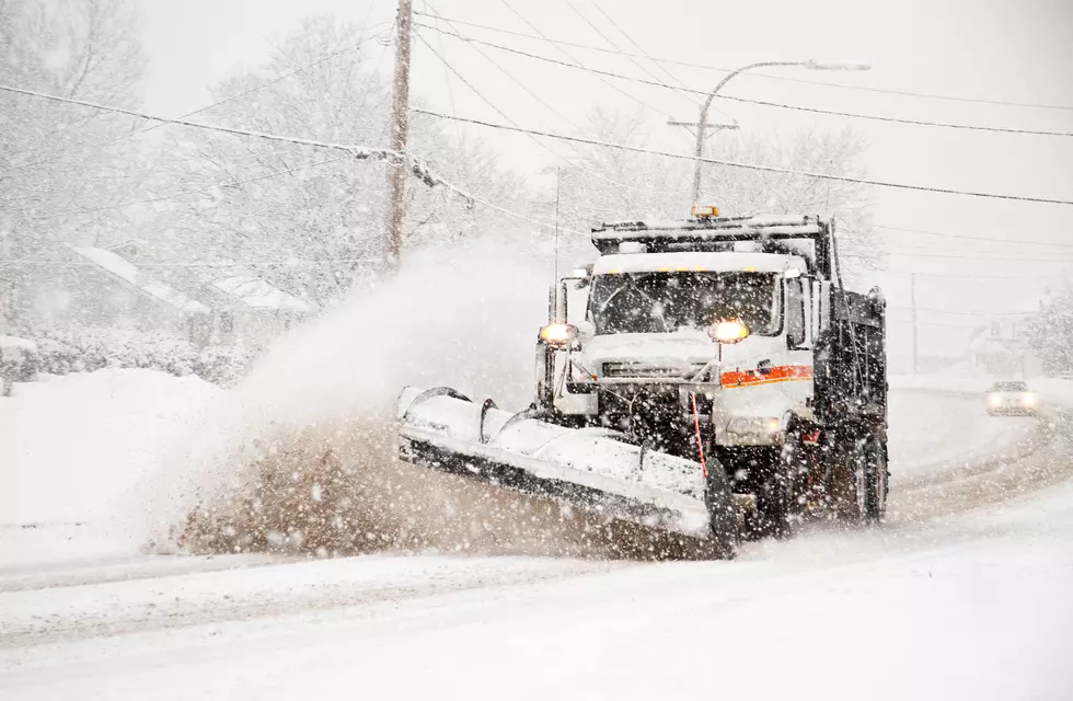
A powerful winter storm will dump heavy snow on the region today and tonight. Forecasters say and strong, gusty winds will create blowing snow and could make travel dangerous by this afternoon. Snowfall totals over the next 24 hours could range from 8 to 14 inches. Most schools in Aroostook County and western New Brunswick are closed today. All state offices, courts, several municipal offices and some agencies are also closed in anticipation of the storm.
STORM CLOSINGS & CANCELLATIONS
TOWNSQUARE MEDIA WEATHER:
- Tuesday ~ Snow accumulating 4 to 8 inches during the day. Blustery with areas of blowing snow. Highs around 28/-2 Celsius
- Tuesday Night ~ Snow may mix with sleet at times. Additional accumulation of 3 to 5 inches possible. Gusty winds and blowing snow. Overnight temps steady in the upper 20s.
- Wednesday ~ Snow tapering to snow showers. Breezy. Highs around 34/+1
- Wednesday Night ~ Cloudy with a chance of snow showers. Lows near 21/-7C
- Thursday ~ Mostly cloudy. A chance of snow showers. Highs in the upper 20s.
U.S. NATIONAL WEATHER SERVICE:
- Winter Storm Warning in effect from February 2, 07:00 AM EST until February 3, 07:00 AM EST
- Hazardous Weather Outlook
- Tuesday: Snow, mainly after 8am. Areas of blowing snow after 10am. High near 29. Blustery, with a northeast wind 13 to 20 mph, with gusts as high as 30 mph. Chance of precipitation is 100%. Total daytime snow accumulation of 4 to 8 inches possible.
- Tuesday Night: Snow. Areas of blowing snow before 4am. Low around 29. North wind 14 to 18 mph, with gusts as high as 29 mph. Chance of precipitation is 100%. New snow accumulation of 3 to 5 inches possible.
- Wednesday: Snow likely before noon, then a chance of snow showers after noon. Cloudy, with a high near 34. North wind 8 to 13 mph. Chance of precipitation is 60%. New snow accumulation of around an inch possible.
- Wednesday Night: A chance of snow showers. Cloudy, with a low around 23. North wind around 6 mph. Chance of precipitation is 40%.
- Thursday: A chance of snow showers, mainly before 9am. Mostly cloudy, with a high near 30. Northwest wind 6 to 10 mph. Chance of precipitation is 30%.
- Thursday Night: Mostly cloudy, with a low around 16. Northwest wind around 6 mph becoming calm after midnight.
- Friday: A chance of snow, mainly after 3pm. Partly sunny, with a high near 34. Calm wind becoming southeast 5 to 8 mph in the afternoon. Chance of precipitation is 40%.
- Friday Night: Snow likely before 4am, then a chance of snow showers after 4am. Cloudy, with a low around 27. Chance of precipitation is 70%.
- Saturday: A chance of snow showers, mainly before 11am. Mostly cloudy, with a high near 34. Chance of precipitation is 40%.
- Saturday Night: Mostly cloudy, with a low around 15.
- Sunday: A chance of snow. Partly sunny, with a high near 27. Chance of precipitation is 30%.
- Sunday Night: A chance of snow. Cloudy, with a low around 14. Chance of precipitation is 50%.
- Monday: A chance of snow showers. Cloudy, with a high near 23. Chance of precipitation is 40%.
The interactive radar has more regional weather. Our app gives you weather alerts & keeps you updated. Free app download.
We have more northern Maine weather info from the U.S. National Weather Service in Caribou.
Stream the station online for the weather. Use the app & listen on the radio.

LOOK: Here are the best small towns to live in across America
More From


